It's hard to imagine our lives before we had satellite navigators. Meanwhile on battlefields, it's impossible to overestimate their combat value. As Russia wages war against ISIL militants embedded in Syria, the issue of accurate and strategic positioning, based on using satellite information, is more relevant than ever.
It's become widely known that American GPS systems can drop out without warning, even in the middle of military action – especially if such an outage might work to the advantage of the USA. We don't have to look far to find examples. American GPS systems failed in Donbass – and somewhat earlier, in August 2008 something very similar happened in the Caucasus.
Against the advent of a repeat, Russia also has its very own satellite navigation system, branded as GLONASS.
The backstory
GLONASS was born back in the days of the USSR. The first test work began as early as 1976 – although the first satellite to support the system only went into orbit in 1982. Although America only began building a global positioning system in 1993, it already had 24 satellites in operational orbit to make it all work.
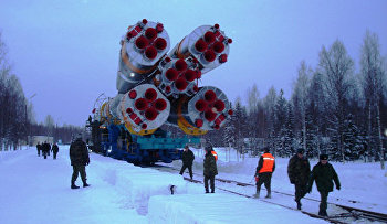
Of course, the American had a helping hand in getting GPS systems up first when the USSR imploded – with the accompanying slowdown of the Russian space program. It was only in late-1995 that Russia was able to field the full complement of 24 satellites needed – but limited operational life, along with chronic funding shortages still failed to provide a reliable and glitch-free network that would cover the planet. Problems occurred not only with the satellites themselves, but also with the rockets that took them skywards. Russia had to wait until 2010 before it had 26 satellites in orbit – 24 operational, and 2 in reserve. Since that time work has continued on fine-tuning their positioning for optimal system use.
Integration and Operation
The idea of using the American and Russian navigation systems in combination occurred almost immediately. This would improve the positioning accuracy while reducing the downsides of relying on systems that could be down. If you think about it, in fact – what do you really need to get your location coordinates? The main criterion is to correlate data signals from four different satellites. Even this isn't always possible, especially in the concrete jungle. High-rise buildings, hills, or even that truck driving in the next lane can block your satellite connection, and take your system down.
Using GPS in parallel with GLONASS improves your chances. You immediately get data from double the number of satellites – so your chances at least four will be accessible are 50% higher. This is the reason why leading device manufacturers produce systems that support dual-system navigation chips. Positioning accuracy improves every year – but if you're hooked up to both systems, the receiver can judge its coordinate position from the most accessible satellites it finds, so that system accuracy and speed are significantly better. Even Americans agree — so far as to put dual-network equipment into all emergency service vehicles.

In a similar way, Russia is gradually acclimatising to the adoption of satellite navigation in our lives. Back in 2009, when GLONASS's coverage already included all of Russia but wasn't yet a fully-fledged global system, it was decided that the city bus fleet in Sochi would be fitted with GLONASS units – as an experiment. The idea took off, and is now slowly being rolled-out across Russia.
There was a recent conference titled 'THE GLONASS ERA,” at which Elena Boiko, Communications Director for the Ministry of Health, said:“All emergency and health transport is now fitted with GLONASS equipment – a total of more than 19,840 medical transport vehicles. We've similarly hooked-up 2659 ambulance control-rooms and admin centers. In addition to this, GLONASS sensors are being fitted to police and emergency services vehicles. The Defense Ministry not left out, the forces can't operate without navigation systems. An upgraded version of the “Strelets” (Sagittarius) hardware can be rigged-up to GLONASS, a military system tough enough to run even in Russia's extreme north. Next year extensive military testing will take place of automated army control systems running GLONASS.
Pay-off and prospects
It might seem that if you have an adequate number of satellites, you can chill out and install GLONASS/GPS signal detectors in every car and mobile phone. Things are not so simple. The systems are continuously being upgraded. Ground stations are going into service for differential correction. A third network of this kind is coming on line soon in Brazil. In fact there really ought to be more than 40 similar networks worldwide, but the US has refused to permit them to operate within its territories.
Canada, however, conceded — which was hardly surprising. GLONASS satellites are pitched at an inclination of 65 degrees to the equator. This means they provide better signal in northern latitudes than GPS satellites, which are angled at 55 degrees. Scandinavian users, for example, have noted the improved GLONASS signal – a factor which will appeal to Canadians too. In addition to the provision of ground stations, GLONASS satellites themselves are improved too. At the same GLONASS ERA conference, Russian Deputy Prime-Minister Dmitry Rogozin announced that within just a few years, all GLONASS satellites will be constructed entirely from Russian components.

Of course, this might produce a few wry smiles, as though Russian components can be found in much of the rest of Russia's economy? But no, Rogozin is right here. There are already two dedicated Glonass-K satellites in orbit. These are third-generation satellites with extended service life, and made entirely from Russian components. And there are nine more of these, already assembled and launch-ready, waiting on the ground. For the present, the GLONASS satellite network is fully complete, so those still waiting will be put into orbit only when an existing satellite reaches the end of its operational life.
On the question of putting satellites into orbit, Russia holds the trump cards – Russia's space program is ready and able to put satellites into space on a regular and ongoing basis. It's not really possible to say the same of the American navigational system.
No look at the future would be complete without some consideration of China's Beidou satnav system. In late September China launched the twentieth orbital satellite, of a total of thirty which its Beidou system will need. If used in parallel with the Russian and American systems, the Chinese system will remove any shade of inaccuracy in positioning, and offer an over-abundance of satellite access at any point on the globe.
Russia, China to make satnav system parts together http://t.co/HiCRWqJ7pr pic.twitter.com/DtsjBwvFOz
— RT (@RT_com) October 12, 2015
Conclusions
Instead of going head-to-head with the Americans, the way forward would be a circumspect joint use of the signals available from Russian, Chinese, American and European systems. This kind of set-up would offer users immediate access to between 20 and 30 satellite signals at any one time. Such a generous availability of data would make signal fall-outs – such as those in Georgia or Ukraine – completely impossible.
Global navigation systems only entered our lives twenty years ago, but have become widely available in far less time than that. Looking to the future of these systems, it will surely not be long before our kids are asking Daddy “what getting lost means?” And we will have to tell them how things used to be in the dim and offline past.


